(Portland, Maine) You can add the town of Cushing to a growing list of communities that are putting local limits on large scale aquaculture. On November 4th, the voters of Cushing approved a moratorium on industrial-scale aquaculture by a wide margin of 467 to 193. Cushing is the latest community to adopt a moratorium on industrial scale aquaculture in its coastal waters and now will build its own permanent ordinance to protect Maine waters against the damaging community impacts of such operations.
Overwhelming Vote in Cushing
This post originally appeared in The Midcoast Villager. Written by Stephen Betts.
Residents in Cushing overwhelmingly voted to enact a 180-day moratorium on industrial-scale aquaculture projects. The Select Board placed that question on the Nov. 4 municipal ballot.
The moratorium on industrial-scale aquaculture projects was approved 467 to 193. The moratorium will allow the Planning Board to come up with recommended regulations that would then have to go to voters.
Report finds aquaculture feed utilizing fish from West African fisheries could impact local food supplies
An investigation by DeSmog through a partnership with investigative journalism platform Follow The Money has reemphasized that the use of pelagic fish from West African fish in aquaculture feed results in lower supplies of food for local residents.
The multi-part industrial aquaculture series by DeSmog has found fish farmed in multiple countries rely on feed that, in some cases, uses fishmeal sourced from West African fisheries with questionable sustainability. The latest report by the news outlet found Dutch supermarkets, for example, sell sea bass which are fed with feed containing ingredients from Senegal’s sardine fishery.
Aquaculture Lease Renewals in Downeast Maine
We have a great deal of information for you today in case you want to submit comments regarding the renewal of the six Cooke Aquaculture lease sites in Downeast Maine. Here is the link to the chart below. https://www.maine.gov/dmr/aquaculture/maine-aquaculture-leases-and-lpas/pending-lease-applications
Once you open the link, you will have to scroll to the bottom to the renewals section. If you open the App (application) link it will show you details about the location.
Law Change
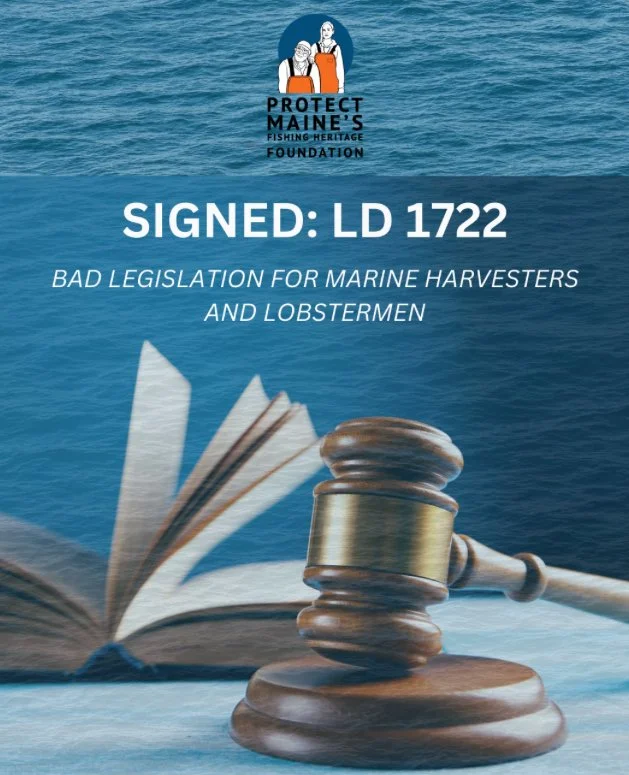
LD 1722 was approved in the legislature and signed by the Governor. Lease renewals are no longer adjudicatory, so there is no longer an option to request a public hearing.
However, there is still a 30-day written comment period, which is the opportunity to submit feedback on the renewal request as it relates to applicable criteria.
Anyone who wants to comment must submit written comments that address criteria for renewal only.
Criteria as listed on the DMR website:
Before the lease expires, the holder may submit a renewal application to DMR requesting that the term be extended for up to 20 years. Standard leases may be renewed if they meet the conditions established in 12 M.R.S.A. §6072(12) and Chapter 2.45:
The lessee has complied with the lease agreement during the term of the lease;
The commissioner determines that renewal of the lease is in the best interest of the State;
The renewal will not cause the lessee to become a tenant of any kind in leases covering an aggregate of more than 1,000 acres; and
The lease is not being held for speculative purposes.
The State must notice riparian landowners within 1,000 feet of the lease site.
Address Comments to DMR Commissioner Carl Wilson and if you have concerns, explain why these leases should not be renewed using the criteria listed above.
Deadlines: The deadline for comments to be submitted is Sept. 28, 2025, at 4:00 pm.
Submit to: DMRaquaculture@maine.gov
DMR Commissioner Carl Wilson will be the final decision maker on whether the state renews the leases.
If you have questions, please feel free to reach out to Protectmaine@gmail.com
Good News in Lubec!
We are pleased to share some very big news! On August 6, 2025, Lubec residents enacted an ordinance that addresses industrial scale aquaculture in their waters. This is a significant victory for the people who love to fish, lobster, and recreate on the water.
The vote was 94-81. This brings the total number of towns that have enacted aquaculture ordinances or moratoriums to eight (Penobscot, Winter Harbor, Harpswell, Cutler, Waldoboro, Gouldsboro, Beals, Lubec) and we are working with towns all up and down the coast that want a say in their future. Each town has either used our ordinance in full, adapted it or chosen to develop their own completely. We applaud each town for doing what is best on their body of water.
While Lubec citizens made their voices heard, the governor chose this session to limit citizen input on aquaculture lease renewals. LD 1722 is a disastrous piece of legislation introduced by a member of the Marine Resources Committee who is also an aquaculturist.
This could directly impact the lives of lobsterman and women and communities in Downeast Maine several hundred miles away from southern Maine and Augusta. It eliminates public hearings on lease renewals. A nod goes to DMR for testifying against the bill as did Protect Maine’s Fishing Heritage Foundation.
We will have more on this later this month including an analysis of what it means and our efforts to combat it. This was an emergency bill signed into law by Governor Janet Mills. Mills has on several occasions publicly backed Cooke Aquaculture, a company that was chased out of Washington State and most recently is being sued by Conservation Law Foundation in Maine for allegations around environmental impacts on Maine waters at the farmed salmon pens. Cooke, headquartered in Canada now leases more than six hundred acres of the Maine water for farm raised salmon. Cooke has been sued by many entities including Wildfish.
Other communities around the world are choosing to eliminate farm raised salmon completely. If you want to see what can happen, this short piece of work from British Columbia is amazing. The work was provided free to us by Tavish Campbell and Deirdre Leoniwata & Moonfish Media.
https://www.protectmaine.com/videos
On a lighter note, Protect Maine’s Sammy the Salmon was in Bangor and Union educating about the effects of industrial scale aquaculture. In Union, Sammy was invited up on the stage to highlight the effort. For a chuckle go to this link.
Protect Maine supports small owner operator aquaculture but not foreign ownership of leases in our Maine waters. If you believe like we do that industrial scale aquaculture is bad for Maine, please consider supporting this work.
We can only do this work with your support and if you can donate, please go to this link.
We are a small but nimble crew of people with the good fortune of having three lobstermen, including Protect Maine’s board President.
Bad Legislation for Marine Harvesters and Lobstermen Signed by Governor Mills
LD 1772, which was passed as emergency legislation and signed by the Governor, is one of the worst pieces of legislation you can imagine. A nod to DMR for testifying against it. It eliminates all public hearings on renewal of standard and experimental aquaculture leases. It’s a rubber stamp from Augusta.
Lubec Residents Push Back on Industrial Scale Finfish Farming
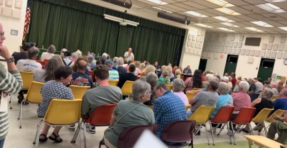
While Lubec residents earlier this month narrowly adopted a local aquaculture ordinance in response to two salmon farm lease renewal requests, whether the ordinance will be legally binding and whether the town has the capacity to administer it are questions that have not yet been determined. Voters approved the ordinance 94 to 81 at the August 6 annual town meeting that drew a large crowd. The close vote may be partly reflective of changing demographics in the Quoddy area, which for decades has been fairly accepting of fish farming.
Ecological Consequences of Oysters Aquaculture
The source, an article from the Journal of Fisheries & Livestock Production, examines the ecological repercussions of oyster cultivation, an extensive global industry employing various techniques. It highlights how improper farm design or management can lead to environmental harm, despite the economic benefits of oyster farming. The paper reviews several negative impacts, including competition for phytoplankton, alterations in seabed topography due to biodeposition, the introduction of invasive species and diseases, adverse effects on the benthos, and habitat modification impacting seabirds. Ultimately, the article proposes solutions such as proper site selection, effective farm management, integrated culture methods, and robust pest and disease control to mitigate these environmental challenges and promote sustainable oyster farming practices.
Maine’s ocean potential is vast if science leads the conversation
Making a living on Maine’s ocean is indeed a tough job. Just ask anyone in the traditional fisheries — lobstermen and women, clammers, and marine harvesters of all sorts. It’s dirty, physical work.
The ocean is the next battleground for so many projects including large-scale industrial aquaculture, offshore wind, and climate change. Embedded in all these conversations is what we want to produce and how we want to do it in our oceans. What are the impacts from any and all of these proposed projects? Maine likes to create task forces, but rarely does it let science or long-term data reviewed by marine industry experts – meaning those people who make their living on the water, lead its decision making.
June 2025 Update
We hope this Protect Maine update finds you and your family well and looking for opportunities to get out on the water whether it’s to make a living, go recreational fishing, boating, or swimming.
We have a lot of work ahead of us to continue to protect Maine waters and keep foreign owned corporations from owning the Maine coast.


